
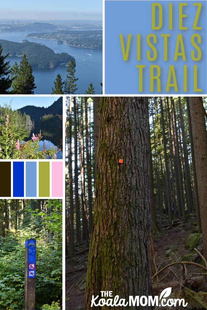
Over the last couple years, I’ve enjoyed doing more hiking as a family, now that our kids are old enough to walk further and enjoy following a trail with me. We’ve had a lot of fun exploring the trails around Vancouver, especially since the pandemic started. Lately, however, I’ve been itching to do something a bit longer and harder than my kids can handle. When a friend of mine from Alberta came to visit, it gave me the perfect opportunity to plan a mom’s only hike on the Diez Vistas Trail.
Last summer, my friend and I did an overnight hike in Golden Ears. A quick day trip in Port Moody required slightly less planning than our overnight hike. We each had a light day pack with water (I packed my usual 3 litres for the day and drank it all) and snacks. I also had my small first aid kit, my big Nikon camera, and a roll of toilet paper. There are washrooms at the parking lot, but nowhere else on the Diez Vistas Trail.
Getting to the Diez Vistas Trail
The Diez Vistas Trail starts at Buntzen Lake, an area we’ve hiked several times now. This recreational area is popular in the summer, so my friend picked me up at 7:30 am and we headed over to Belcarra to wait for the gate to open. Apparently we weren’t the only ones with this idea, as we found ourselved parked on the road with about fifty other cars.
At 8 am, the park staff opened the gates and we filed in to find a parking lot. During the summer (and the pandemic), if you want to explore this area, you need to be there at 8 am as the gates close when the parking lots reach a certain capacity. Park staff don’t seem to be letting anyone in later in the day, even after people have left.
Hiking around Buntzen Lake
Buntzen Lake and any surrounding trails are currently supposed to be one-way to facilitate physical distancing, so my friend and I followed the arrows down the west side of Buntzen Lake. We passed slower groups of hikers, and were passed ourselves by trail runners, but everyone seemed to heading in the same direction until we got further down the trail. Then we began meeting people hiking the trail in the opposite direction, so not everyone is following the one-way signs.
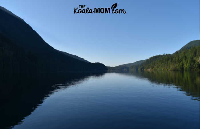
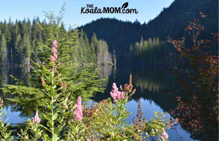
The west side of Buntzen Lake is the easiest part of the hike. Here, the trail is fairly wide and stays close to the lake shore, so there are small ups and downs but the trail is relatively flat. In an hour, my friend and I found ourselves at the beach on the north end of the lake. The sun wasn’t yet up over the mountain and the lake was as smooth as glass, except for a few paddle boarders gliding across its surface.
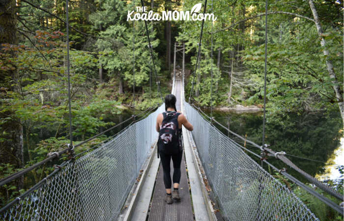
We admired the view and took a few pictures and then resumed our hike. After the beach, the trail crosses a suspension bridge and then veers to the left.
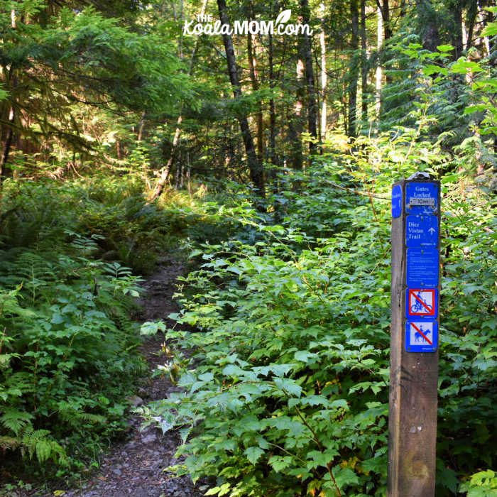
Finding the Diez Vistas Trail
I got a bit confused here, as the map showed that the trail went right. We ran into another couple hiking the Diez Vistas Trail as well, and they assured us that we keep going and look for signs for the Old Buntzen Lake trail. We continued on until a fork in the trail, with an old sign post indicating the Old Buntzen Lake Trail.
We turned to the north and hiked along, until the trail split again. Here we paused, once again confused, until the same couple caught up with us and told us to stay right. This brought us down to the small lake at the north end of Buntzen Lake. The trail hugged the shore of this lake for a bit and then curved around to take us up the ridge and back towards the parking lot.
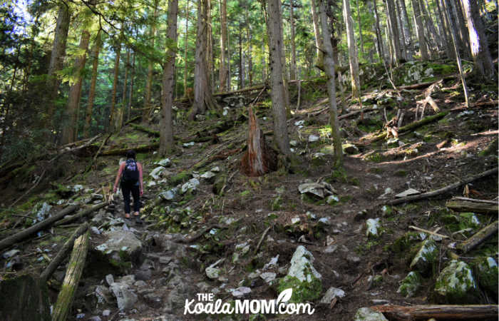
Here we found another trail sign that let us know we were on the Diez Vistas Trail, and reminding us that the park gates close at 7:30 pm. From here, the trail went up and over the ridge and was fairly obvious in most places. When roots and rocks made the trail a bit harder to find, there were orange trail markers on the trees for us to spot.
We talked as fast as we walked. The trail wound steadily upwards through trees and over rocks. We followed a solo hiker and knew that another couple was behind us, but for the most part, we’d left behind the crowds of hikers on the west trail between the south and north beaches. Once we got about halfway over the ridge, however, we began to meet more hikers, going in both directions. The trail was actually more busy than I’d expected.
We’d been warned that the Diez Vistas Trail no longer had the ten scenic viewpoints, but only two or three. Trees have grown up since the trail was first established, blocking several of the views. Sure enough, the first viewpoint we found was a nice space of boulders at the top of the ridge with a glimpse of sandy beach and red roofs through the line of trees. We kept hiking, and soon found another viewpoint.
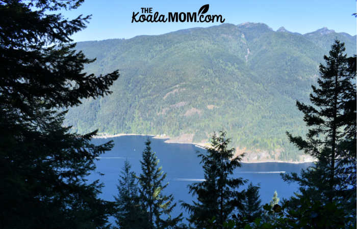
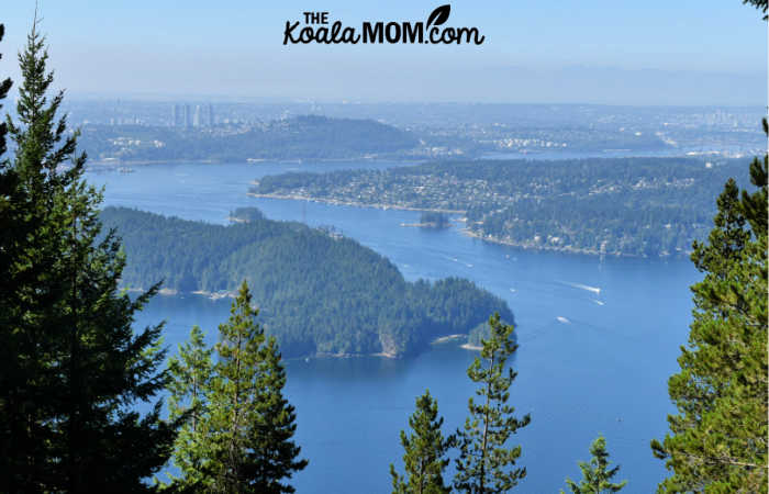
Here, we pulled out our smartphones and used Google Maps to figure out where exactly we were. I knew that Buntzen Lake was behind us, but couldn’t remember what body of water was in front of us. Thanks to Google Maps, we learned we were looking down at Indian Arm, with Mount Seymour directly across from us. I wondered if the small clearing and red roofs we saw at the top of the mountain was the ski area, but I wasn’t totally sure.
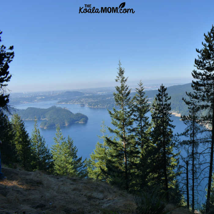
The views got better as we continued along the Diez Vistas Trail. There weren’t ten views, but there were definitely more than five. We stopped to have some snacks at one viewpoint and take pictures at another viewpoint. It was a hot, sunny day, so we could easily see downtown Vancouver and across Burnaby, with towers rising above the hills and valleys of the lower mainland.
After the last viewpoint, the trail turned back towards Buntzen Lake and began snaking downward through the trees. In a few places, it was quite steep. As we reached the flatter area near the lake, we began crossing other trails. Thankfully, there was good signage here and I had some sense of direction again, so we continued heading towards Buntzen Lake.
Returning to the Buntzen Lake Parking Lot
We popped out of the trees onto a service road. Glancing up and down, we saw a blue sign to our left that said “access to South Beach.” As I’m slightly directionally challenged around Vancouver, I failed to realize that we were trying to get back to the South Beach, and so we turned to the right and followed the road for a little ways. When we reached the end of the lake, I knew we’d gone the wrong way. We backtracked to the sign again and found out that it was the bridge across the end of the lake that I’d been looking for.
From there, it was a short hike to the main parking lot. We’d hiked 15 km in just over 5 hours, and we had the sore muscles to prove it.
Overall, it was a stunning hike with good views and pretty scenery along the way. If I hiked it again, I’d probably avoid the busier east side of Buntzen Lake, and instead stay on the west side of the lake. The trail is marked as “intermediate” by Vancouver Trails and I’d agree with that rating. Except for the old signage at the north end of the lake, the trail was easy to follow and not particularly difficult.
Note: Buntzen Lake is accessible by bus if you don’t want to deal with traffic and parking.
No Responses Yet