
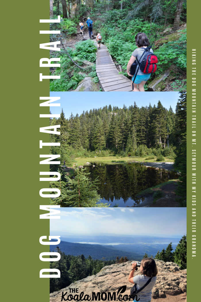
When my mom came to visit at the end of this summer, I looked for a trail to hike together. I wanted a kid-friendly trail that we could hike in half a day—something that wouldn’t be too easy and not too hard. I chose Dog Mountain Trail on Mount Seymour as a scenic, fun trail that offered a great viewpoint for eating our lunch.
This post contains affiliate links; as an Amazon associate, I earn from qualifying purchases.
We’ve hiked this trail as a family a few years ago, and I remembered it as a relatively easy hike. For a viewpoint trail, it doesn’t involve any steep ups or downs, because you drive up to the ski resort parking lot and then hike across to the lookout. The trail is also under 6 km (depending on which map you look at), which is quite doable for my kids. However, when we finished, my mom (an experienced hiker) said she wouldn’t call it an “easy” trail due to the roots and rocks we had to climb over.
Vancouver Trails described this trail as “a short, easy hike from Mount Seymour that offers a spectacular view of Vancouver on a clear day. While the trail has minimal elevation gain and is only about 5km return, it should be noted that the path is a bit more technical, requiring careful steps along several sections that are covered with slippery tree roots. Therefore, some hikers may find this trail on the more challenging end of the ‘easy’ rating.”
Getting There
Dog Mountain Trail is located on Mount Seymour. Drive up the Mt. Seymour road to the ski resort parking lot. The trail leaves from the farthest end of the parking lot, so drive past the ski lodge and washrooms. You’ll see a little trail information kiosk there, with maps and information. This is a great place to get a group photo before you start hiking.
We’ve spent several winters skiing and sledding at Mt. Seymour, so it was rather fun to be up there in the summer. The parking is definitely much better than in the winter! The cafeteria there is also open if you want to pop in for an after-hike snack.
I made all the kids use the washrooms before we started hiking. I took a picture of the map too, as there is cell service on Mt. Seymour but it’s sometimes spotty. My teen had stayed home, so I kept texting her updates about our adventures and occasionally the message wouldn’t send due to poor service.
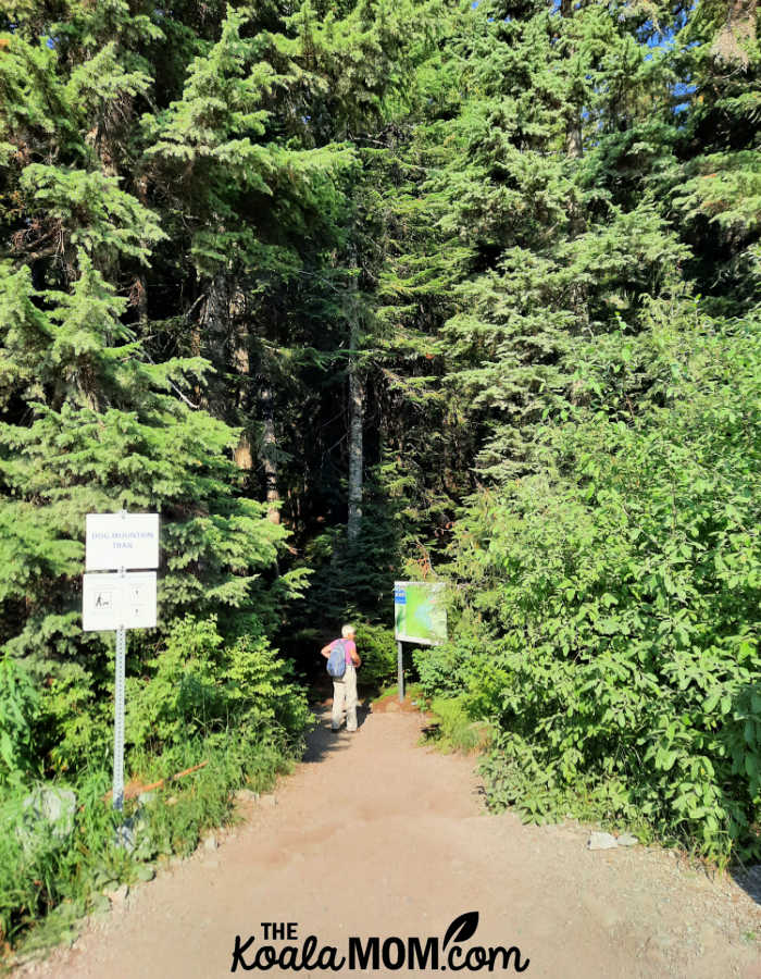
To get to the trail, hike past the Bear’s Den hut towards the Mystery Express Chairlift but keep to the left. The trail veers off into the trees just at the bottom of the lift. There was a big sign here as well as another map of the area.
Hiking Dog Mountain Trail
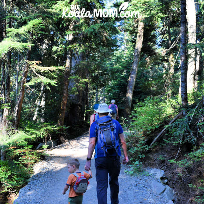
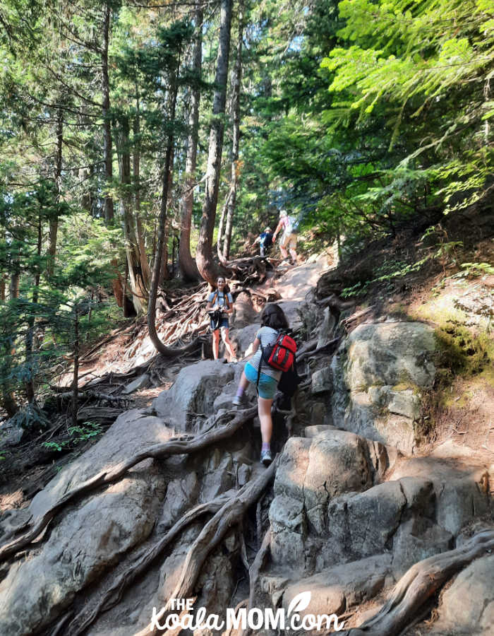
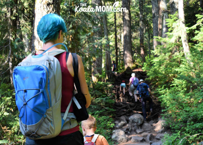
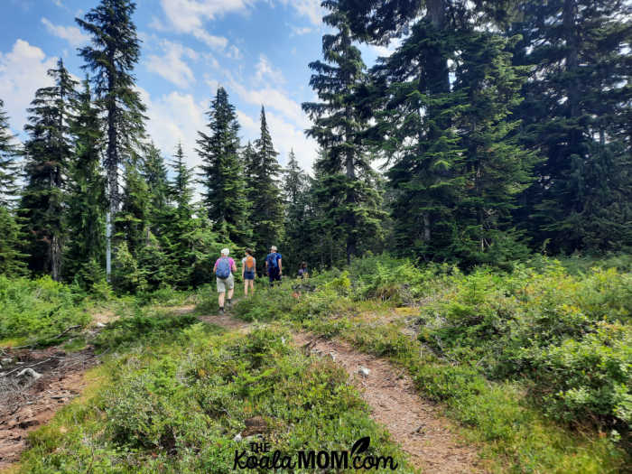
The trail was well-marked and the first part of it was wide and flat and gravel. We were able to walk two-by-two. Joey (my 4-year-old) held my cousin’s hand and chattered to him as we walked. I was so proud that he did this entire hike (7+ km by the end of the day) all on his own, and only asked once to have a piggy back ride, then kept walking when I said I had a big backpack on and couldn’t carry him too.
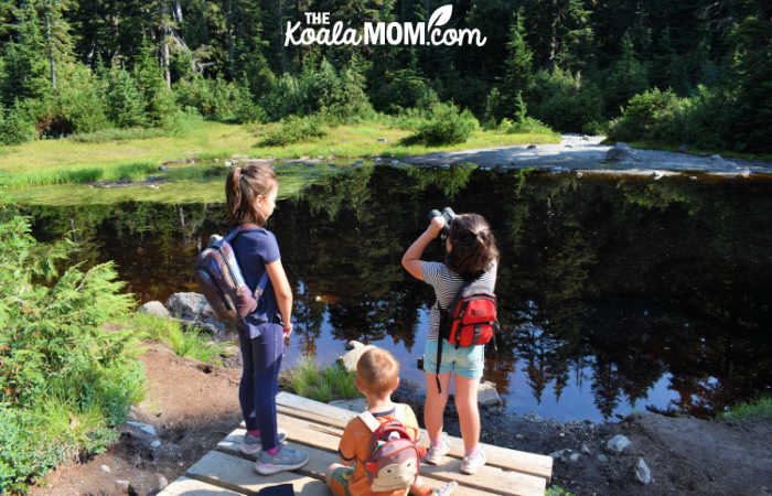
The first landmark on the trail, about halfway between the trailhead and the viewpoint, is First Lake. This very small lake has a boardwalk on the left side, along with a small “dock” or viewing area. We sat here for a minute to look at the lake (which is very small and very shallow). I let the kids pull out the binoculars and see what they could see in the surrounding trees. Lily (my 12-year-old) had my DSLR camera and took most of these pictures (plus a few hundred more).
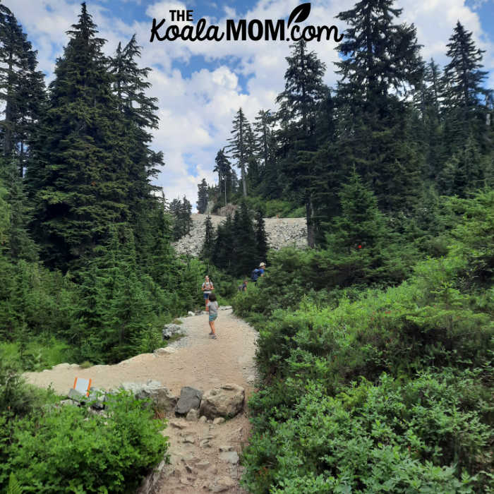
From First Lake, the trail gets a bit more “technical,” with a lot more roots and rocks to clamber over. Parks crew were working on improving the trail, not only for greater ease of hiking but also to protect the tree roots and other plants in the area. Many signs reminded hikers to stay on the trail to protect the fragile ecosystem here (which is handy because I’m always telling my kids to stay on the trail too, for safety as well as protecting the environment we hike through).
Joey was quite delighted to see the trail crew at work and stopped to ask them several questions about their tools and what they were doing. He probably would have talked to them for an hour if I hadn’t nudged him along the trail.
The Dog Mountain Viewpoint
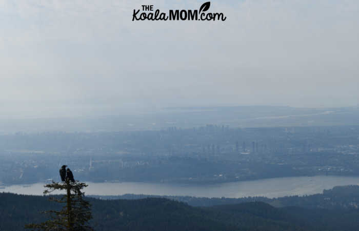
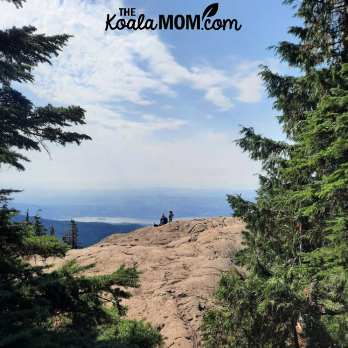
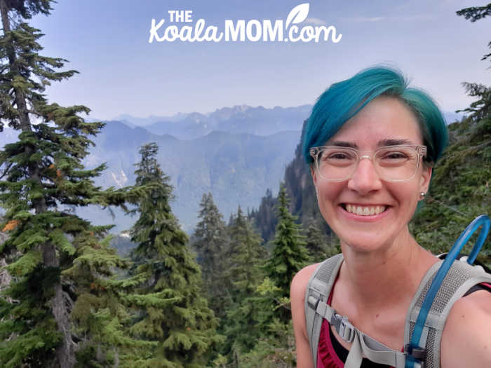
It took us an hour and a half to hike from the trailhead to the viewpoint, including the brief stop at First Lake. The viewpoint is definitely worth the hike, as you get a view of most of Vancouver spread out before you. It was a little bit hazy on the day we were there, so it was harder to make out Vancouver Island or other places in the distance, but we could easily see the Burrard Inlet below us.
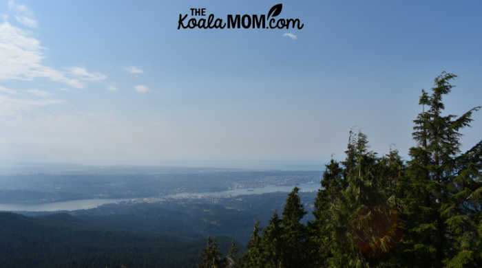
As my mom is from Alberta, and my cousin does a lot of cycling, it was fun for us to use the viewpoint as a birds-eye map and figure out various landmarks and places we’d been. We could pick out the bridges over the inlet and the towers of various city centres and the rivers meandering along.
We enjoyed the views, and then went back a little ways to sit in a shady copse of trees and eat our lunches. The younger kids were quite happy to play here in the trees and I had to keep encouraging them to have snacks and water. I knew if they didn’t eat and drink, they wouldn’t be feeling very well later, but they were pretty happy just to be taking a break.
Trying to Find Mystery Lake
After eating our lunch and enjoying the views (with quite a few other hikers—the trail was fairly busy at this point), we started back. On the map, I’d seen a trail from First Lake to Mystery Lake (in the middle of the ski area) and wanted to try finding that, as Mystery Lake was supposed to be beautiful. At First Lake, we took the trail to the left around the lake instead of staying on the main trail to the right.
We hiked most of the way around the lake before finding the trail that veered left again towards the Mt. Seymour ski area. There was a sign here, but the trail was much narrower than the Dog Mountain Trail. We hiked single file. The kids were at this point getting a bit tired, so when we hit another trail junction (again, marked by a sign), we stopped to take a break and have more snacks.
I’d packed my largest daypack for this trip, with my 3-litre Platypus full of water. I tried to make sure I packed a good lunch as well as quite a few snacks, but I should have had more granola bars or candy to keep the kids motivated. Each of the kids had their own backpack with a water bottle, snacks, and whatever else they wanted to carry (spare diapers for Joey, a notebook for Jade, etc.). Although I didn’t carry Joey, I did end up putting his backpack in mine, then strapping Pearl’s backpack to the outside of my daypack, and taking the DSLR from Lily too when she got tired.
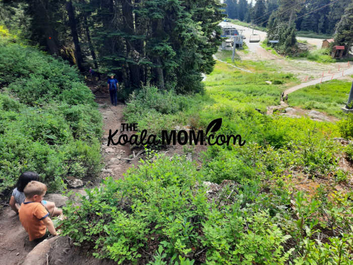
We passed a couple boys who’d been fishing at Mystery Lake and had no luck so were heading to First Lake. Excited that we were close, we kept going. Our trail met the ski area, at the edge of the Upper Manning Run. We knew that area well from skiing down it so often, but the trail and signs seemed to disappear here. There was nothing to show us how to get to Mystery Lake.
We turned left and hiked up parallel to the ski hill. The trail here was very rough and quite steep, but we kept encouraging the kids with thoughts of Mystery Lake. Then the trail ended. We were at a lovely viewpoint looking back at Dog Mountain where we’d eaten lunch, but we couldn’t see how to get from here to Mystery Lake. There was now a gully between us and the ski run, and Mystery Lake was somewhere on the other side of the ski run. We sat down for more snacks.
After our break, we hiked back down to where the trail had split, and then hiked up onto the ski run. It was a wide gravel road down the mountain. I’d already seen one pickup truck heading up this road, so I wasn’t sure we wanted to hike down it. My cousin and I tried to find maps on our phones, but nothing gave us a really clear indication of how to find Mystery Lake from there. With the kids tired and complaining and already heading downhill, we chose to simply follow the ski run down.
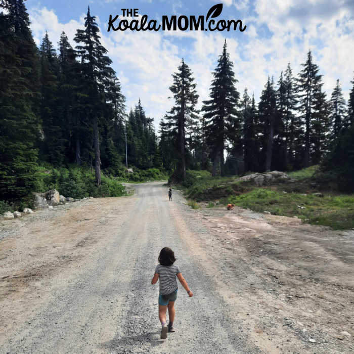
Once again, because we’ve skied here for many years, it was kind of fun to see the places we know so well. “That’s Elevator Shaft,” the kids said, pointing to one trail while we took the Manning Bypass towards the chair lifts. They shared a few ski lift stories as we hiked underneath it. Then we had to get out of the way for the truck that was coming back down the mountain.
At a curve in the road, it looked like we could hike over to join the Mystery Lake Trail rather than following the road down. We convinced the kids to give it a try (although at that point, since we’d been looking for the trail for so long, they were rather dubious about our suggestions). The trail was easy to find and followed another ski run down, but this run was full of low alpine plants rather than an access road.
As we hiked down, we met several families and groups heading up to Mystery Lake, with their water gear over their shoulders. I was disappointed we hadn’t been able to find it, as a swim in a cold lake would have been lovely after a hike on a hot day. We stuck to the easy way down, which brought us out underneath Mystery Express and to the trail kiosk where we’d started our hike.
It took us three hours to hike from the Dog Mountain Viewpoint across to the ski run and then down to the parking lot, including our lunch break and two snack stops. The trail was scenic and easy to follow all the way, and we passed quite a few other hikers and dog walkers along the way. However, the lack of signs once we reached the Mt. Seymour ski area were very disappointing, especially since it was the map at the trailhead kiosk that had made us think we could hike from Dog Mountain across to Mystery Lake.
My cousin and I plan to head back sometime to hike the trail from Mystery Lake to Dog Mountain and try to find out where we missed the trail. When we do, I’ll tell you all about it!
No Responses Yet