
One rainy day in Wells Gray Provincial Park during our summer holidays left us wondering what to do. Many of the hiking trails have thick brush, meaning we’d be dealing not only with rain falling but also water hanging on the trees and branches we were brushing past. I didn’t want to deal with cold, wet miserable kids after such a hike. As I browsed through Exploring Wells Gray Park, another idea came to me: drive the Clearwater River Road.
Author Roland Neaves had mentioned some scenic hikes off this old logging road (not to be confused with the Clearwater Valley Road, the main road to the lake and campground). The Clearwater River Road is now seldom used and sounded like an interesting place to explore. So we piled into my truck and drove back down the Clearwater Valley Road and through Clearwater to find the Clearwater River Road.
After one wrong turn where we ended up on a real logging road (with a real logging truck), we found the right road. A big brown sign warned us that if we were trying to find Helmcken Falls, we needed to turn around and go up the Clearwater Valley Road instead. We’d already stopped at Helmcken Falls that morning on our way out from the campground, so we were ready to see what we could see on this side of the river valley.
This post contains affiliate links; as an Amazon associate, I earn from qualifying purchases.
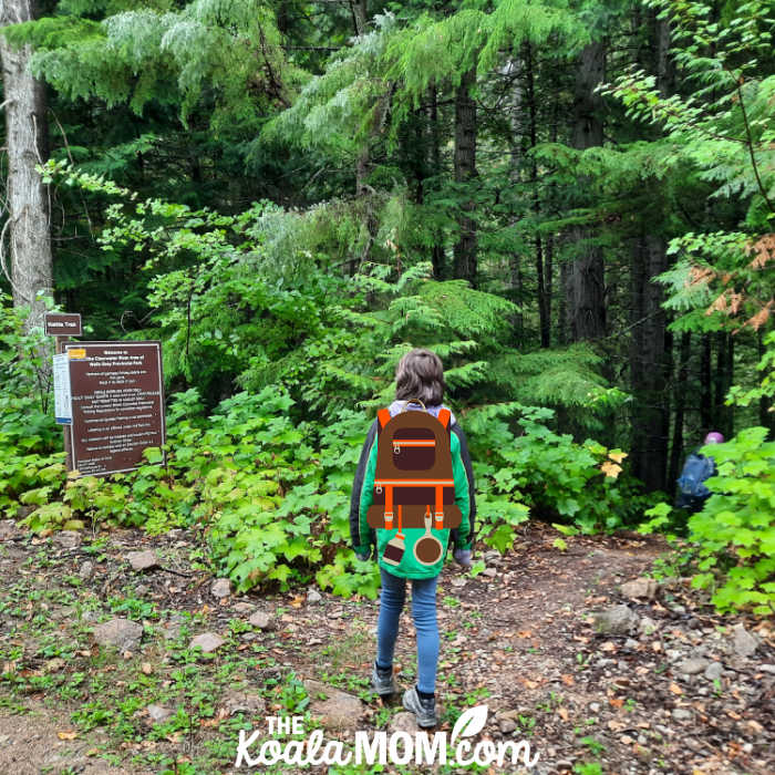
The Kettle Trail
Our first stop on the Clearwater River Road was the Kettle Trail. There was a little pull-out where we could park and a sign marking the trail into the forest. The trail itself was fairly easy to follow, with boardwalks and bridges in some muddy parts.
We missed the actual viewpoint of the Kettle on our first try. Jade was running ahead, with my mom’s dog chasing her, and I was chasing Joey, so we didn’t see the narrow trail down to the river. The trail we followed reached the road, making us realize we’d missed seeing the Kettle (the cataract on the river). So we went back, this time watching the river side of the trail more closely, and saw the narrow trail that split off to a bluff above the river.
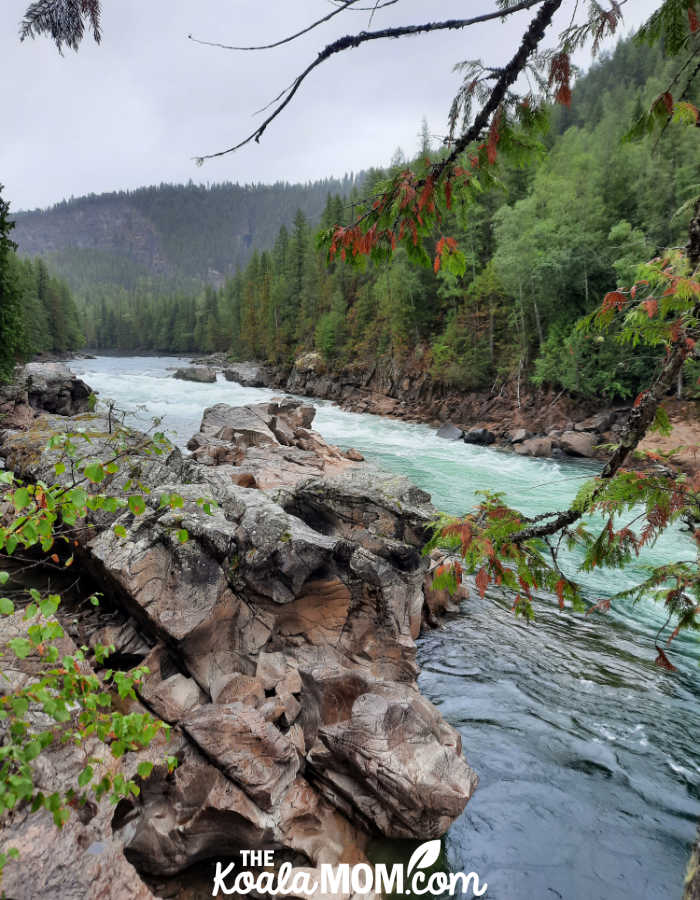
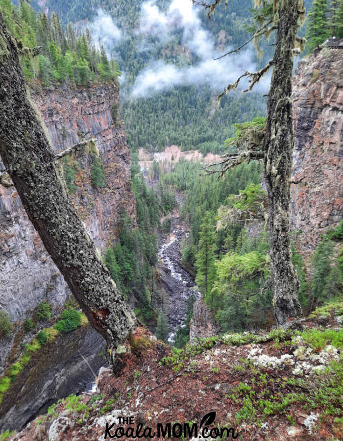
From there, we had views both up and down the river. Evidence of erosion was clear on the rocks around us, which looked like playdough squashed by giant fingers. Across the river from us, we could see the old lava flows that Ronald Neave often mentioned in Exploring Wells Gray Park. Above us, the canyon walls soared high. The Clearwater River crashed through the Kettle, confined between narrow rocks, and then continued on its way downstream.
A bald eagle left its tree top perch and flew to another, where it sat watching the river. We didn’t see any salmon, but the one other couple we met on the trail said they had (if you watched long enough).
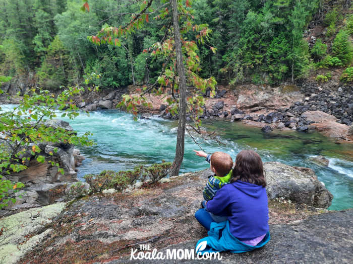
We sat on the rocks here for quite a while, watching the river go past around us and talking about the scenery. I should have brought our Roland Neaves book to read more about the area, as I was trying to remember what I’d read back at our campground. Joey sat in Sunshine’s lap while she pointed out the landmarks to him.
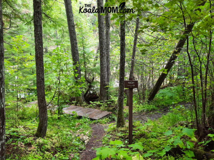
Then we hiked back up the trail. There was a fork in the trail just at the end of the boardwalk, with a sign pointing to an outhouse. Joey, Pearl and I took the fork to see what we could see. Along this trail, which went downriver, we caught another glimpse of another cataract in the river. After about a five minute hike, we found an old outhouse at what looked like a whitewater rafting put-in location.
Then we went back to the Y in the trail and hiked up to the road, where we piled back into the truck and continued driving down the Clearwater River Road.
The Sandy Beach
Next, we came to a lane going down to the river, so we parked and went to check it out. The lane seemed like another whitewater rafting place, but we also found a beautiful sandy beach in the crook of the river. The kids dashed along the piles of sand while the river—which has been so crazy and tumultuous at the Kettle—now flowed in deep, smooth currents.
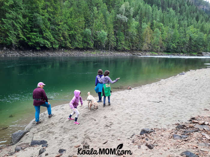
My beach-loving West Coast kids soon had their socks and shoes off to wiggle their toes in the sand and go wading. They wanted to go swimming, as the water looked very inviting, but I warned them that it was moving faster than it looked and they couldn’t go in beyond their knees. They dug in the sand, threw rocks into the river, and explored a little ways along the shore. I marveled at this giant hill of sand here, when the other banks of the river were so rocky.
Finally, we pulled the kids off the beach and kept driving down the Clearwater River Road, curious about what we’d find next.
The End of the Road
We didn’t have much further to go. The road used to stretch 30-some-odd kilometers along the Clearwater River. After the beach, the road was much rougher and narrower. I put my truck into 4×4 just in case and hoped we didn’t meet anyone coming towards us. I began taking note of locations where the road was wide enough for a 3-point turn and wondering how far I’d have to back up if we hit a fallen tree or rockslide.
Around 10 km, we reached a rockslide that had closed the road permanently. We parked (there was plenty of room for that, and turning around) and went to check it out.
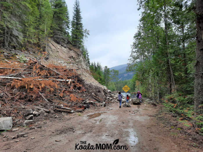
A yellow sign announced “Road Closed” but it was clear that no vehicle was going past here. Large boulders had fallen from the hillside above, along with trees and gravel and dirt. It would take a lot of work to clear the landslide and make the road stable enough for traffic again. Once past the sign, we could see where the Clearwater River Road continued meandering along the edge of the river. However, it was also close enough to the river that it seemed erosion had happened on that bank, as well as above from the landslide.
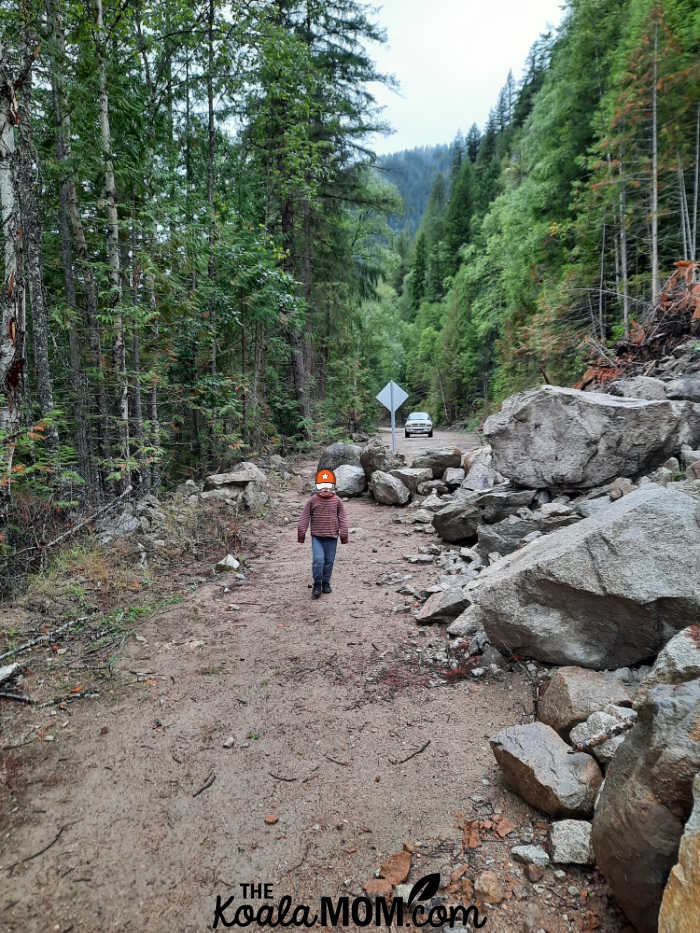
While the remaining twenty kilomters of the Clearwater River Road are closed to vehicle traffic, it did look like a lot of fun to either hike or bike along the road. I’d definitely consider coming back to do that, and to see what other scenery we could see along the way. There were several more viewpoints and natural features mentioned by Roland Neaves, including a glimpse up the canyon to Spahats Falls on the opposite bank.
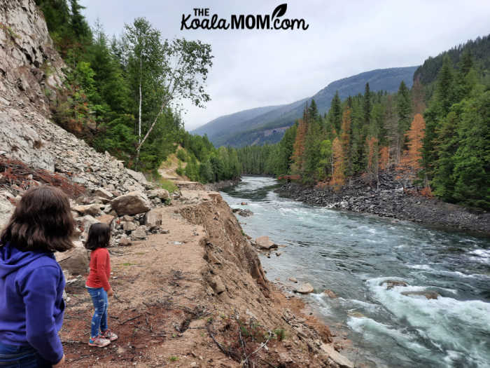
We climbed back into the truck, pulled a 3-point turn, and headed back down the road, quite happy with our adventure. We passed one other SUV on its way to the end of the road. Then we continued through Clearwater and back onto the Clearwater Valley Road, where we stopped at Spahats Falls. From the viewpoint above the falls, we could see way down through the canyon to the Clearwater River and the road where we’d just been standing, including the landslide where we’d stopped.
If you are visiting Wells Gray Provincial Park, the Clearwater River Road is worth checking out. The Kettle Trail is an easy, scenic hike that is well-worth the drive, and the road to that hike is decent. If you do choose to go past the lane to the river which marks the sandy beach, I do recommend having a 4×4 or a vehicle with decent clearance. It’s also a good idea to leave a trip plan with someone who knows where you are driving / hiking and what time you expect to be back.
What’s your favourite place to explore in Wells Gray Provincial Park?
No Responses Yet