
For the last twenty years, I’ve dreamed of someday hiking the West Coast Trail. I’ve heard about this rugged yet scenic trail on the southwestern side of Vancouver Island from several of my friends, and longed to experience it myself. When my cousin emailed me in December to ask if I wanted to hike it this year with her, I said yes.
This post contains affiliate links; as an Amazon associate, I earn from qualifying purchases.
Planning to Hike the West Coast Trail
The West Coast Trail is one of British Columbia’s most popular hikes. Reservations for the year open in January and fill up almost immediately, as only 8,500 people are allowed to hike the trail between May and September. The 75-km trail is renowned for its rugged beauty, challenging terrain and unique history.
In December, my cousin put together a group of four hikers. In January, she made our reservations for us. When one person had to cancel their reservation, I invited my childhood friend Angie to join us. We grew up together until her family moved to Colorado nearly twenty years ago (just before my best friend’s older sister hiked the WCT and first told me about it!). Angie and I had done four overnight backpacking trips together, in Ram Range and Jasper National Park, before going on the West Coast Trail.
Over the summer, emails flew back and forth among us as we planned our trip. My cousin and her friend hiked part of the Juan de Fuca trail as training; I did an overnight trip into Golden Ears with another friend of mine to test my gear. I bought new hiking boots and a water filter and borrowed a rain coat and pack cover from my mom.
Finally, at the end of August, I drove my kids to my mom’s place to spend the week. Then I boarded a plane with my pack to fly to Victoria.
Our West Coast Trail Itinerary
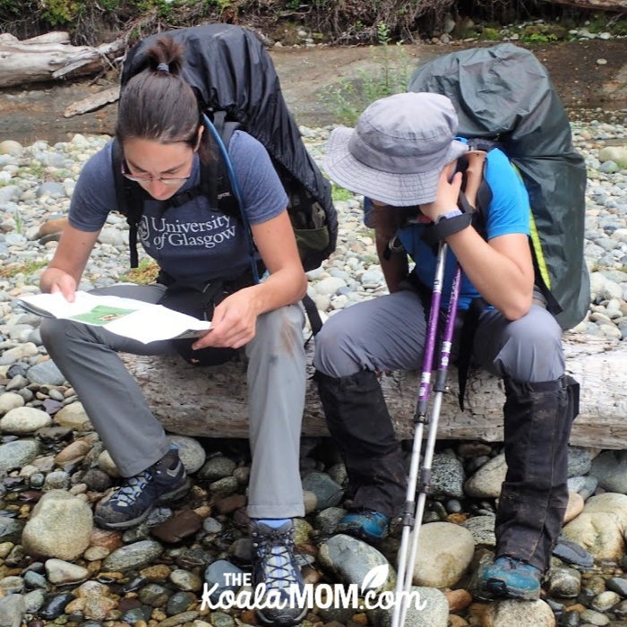
With tips from a friend who’d recently hiked the trail, my cousin planned an itinerary for us. We stuck to the plan until the second last day, when we arrived early at our planned campground and decided to push on an extra 2 km (just for fun).
Day 1: Gordon River to Thrasher Cove (5 km)
Day 2: Thrasher Cove to Cullite Cove (12 km)
Day 3: Cullite Cove to Cribs Creek (16 km)
Day 4: Cribs Creek to Tsusiat Falls (17 km)
Day 5: Tsusiat Falls to Michigan Creek (13 km)
Day 6: Michigan Creek to Pachena Beach (12 km)
WCT: Day 1
On Wednesday morning, we woke up at my cousin’s place. We had our backpacks “mostly” packed and waiting by the door. My cousin made us a quick breakfast before her dad showed up to drive us to Port Renfrew. For me, driving through Victoria and south along the highway brought back a host of memories from our four years spent on Vancouver Island.
We reached Port Renfrew at 9:30 am, just in time to check in for our orientation session. A one-hour West Coast Trail orientation is mandatory for all hikers before starting. The ranger gave us a slide presentation about the weather for the coming week, current trail conditions, wild animal safety tips, tsunami safety, and what to do in case of an emergency. Then she gave us our permits and waterproof maps and we were ready to hike.
My uncle took a group photo of us before starting the two-hour drive back to Victoria. Full of excited energy, we followed our fellow hikers down the road toward Butch’s.
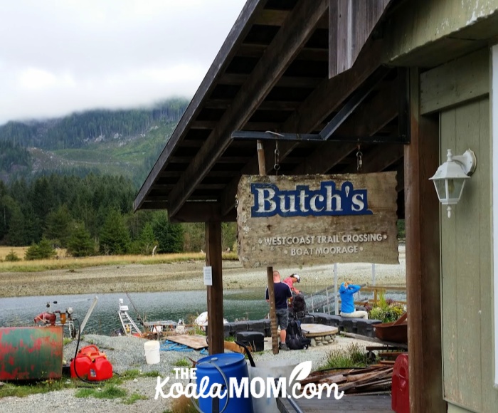
We had time for a quick snack before Butch appeared and waved us onto his boat. He was a stocky, no-nonsense Native man who ferried us across the Gordon River to the official start of the West Coast Trail: a vertical ladder up the cliff.
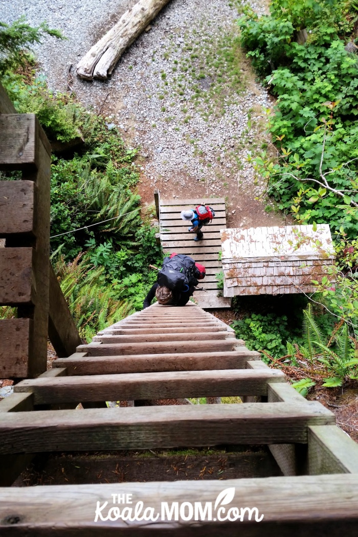
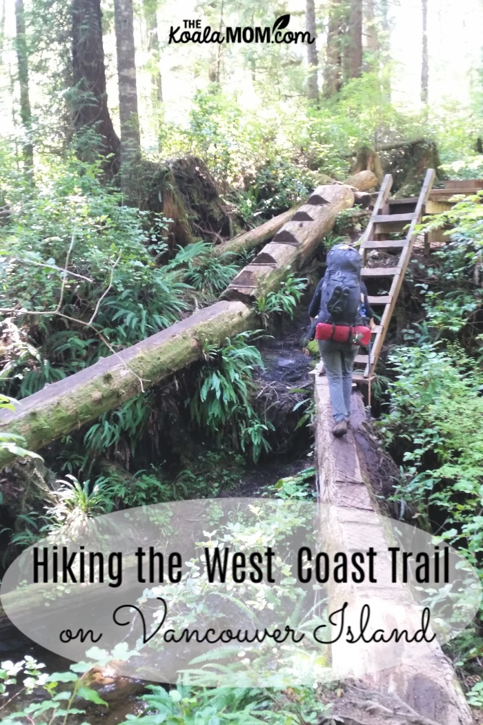
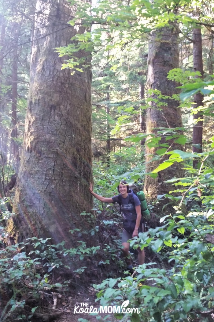
Our first day on the West Coast Trail was only 6 km. Those few kilometers, though, were a good taste of what was to come. The trail meandered up and down through the coastal forest—terrain I’ve experienced on many a dayhike around Vancouver and Victoria. There were also the legendary WCT ladders, taking us up and down steeper sections of the trail or across streams and gullies.
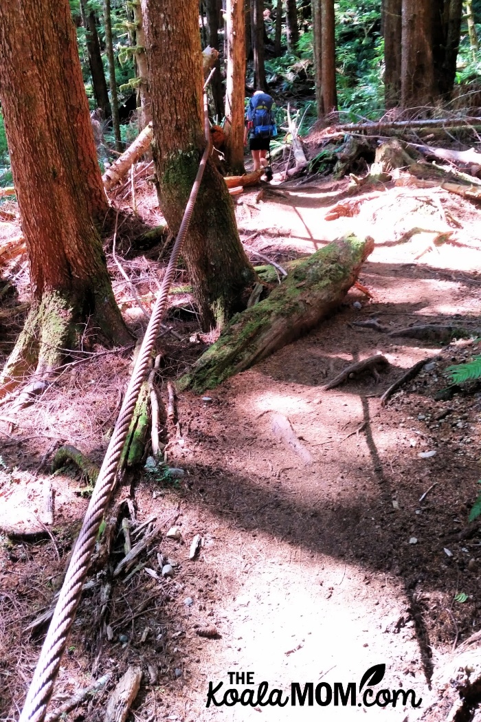
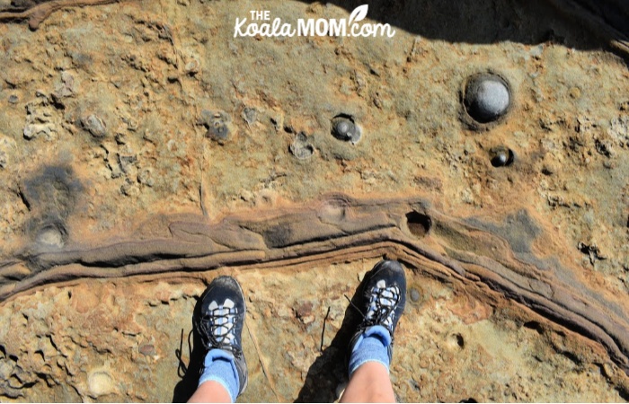
The history of the WCT was also evident along the trail. We saw the old telegraph wire still hanging between trees, with a few glass insulators high up in the tree. A logging cable ran beside the trail for well over a kilometer, laying coiled on the ground in some places and stretched taut above our heads in other places, with trees growing around it and nails attaching it to old stumps.
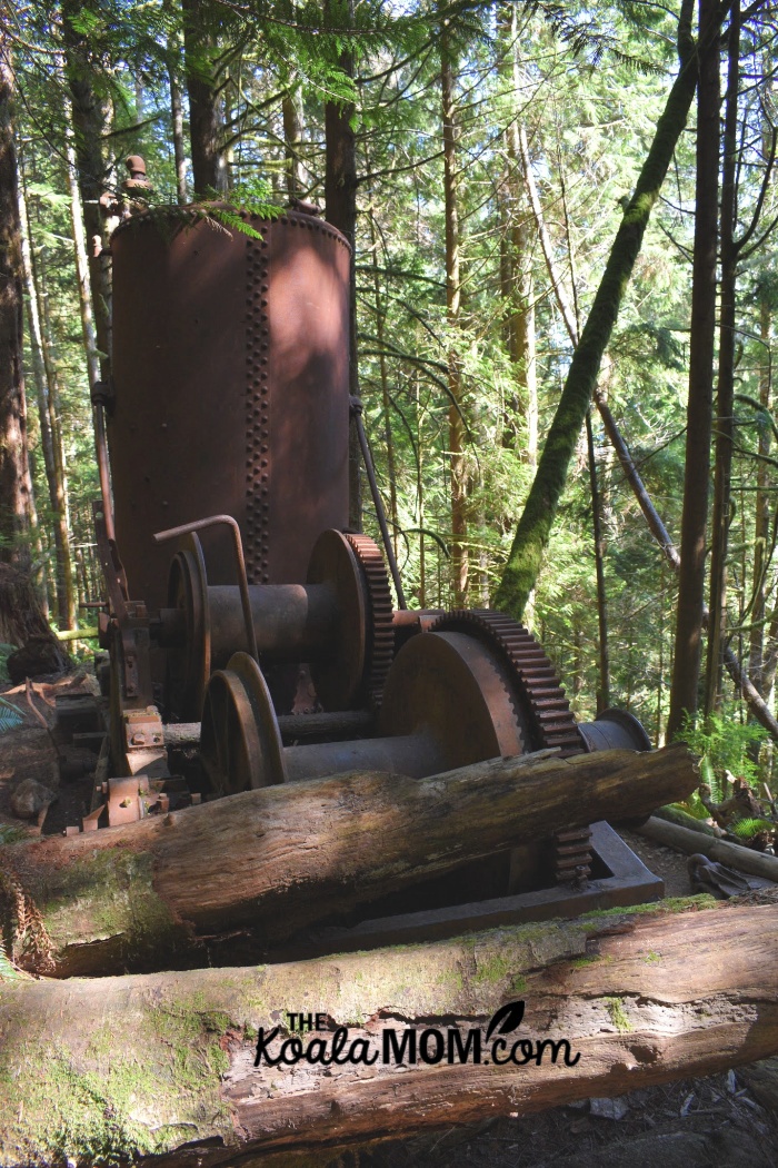
A derelict donkey engine was one landmark that let us know how far we’d hiked that day. We wondered how that enormous, rusty piece of equipment had been hauled up there and what it did in its day.
We’d been warned that these 6 km were hard and could take over three hours to hike. An intersection in the trail, with signs for Thrasher Cove 1 km and Gordon River 5 km, were a welcome sight. In that kilometer, we dropped “like an elevator,” according to the authors of Blisters & Bliss, to the beach campground. We knew we’d gotten there when we reached the top of the ladders. Yes, multiple ladders—I lost count after about four.
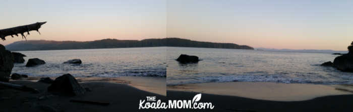
Nearly every inch of sand in Thrasher Cove was covered either with tents or driftwood. The empty sections were in front of the outhouses or in the path of the incoming tide. We looked up and down the beach, then clambered over some driftwood to find just enough space to pitch our tents among a circle of logs. And then, with our territory staked out, we were free to enjoy the fruits of our labour.
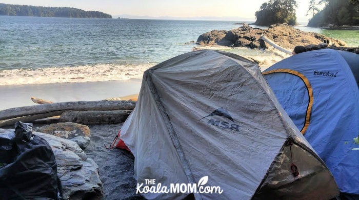
Sitting on that sandy beach, listening to the waves rolling in at my feet and watching the sky gently turn to pinks and purples over Botanical Bay across the inlet, I was tempted to pinch myself. For ten months, as we’d planned meals and gear and so many other details, I’d hardly dared to believe I would actually be doing the West Coast Trail. I was so worried something would come up to prevent this trip that I hadn’t really let myself get excited until I began packing the week before.
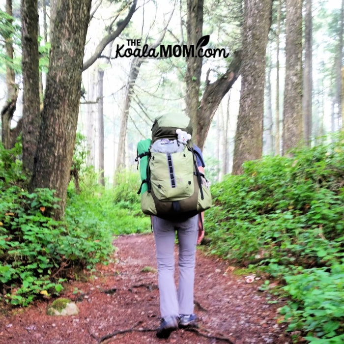
All that day, I’m sure I could have floated down the trail if the 38 pounds on my back hadn’t kept my boots firmly on the trail. After not backpacking for more than a decade because of babies and moves and school and other excuses, here I was, on Canada’s most legendary trail with my cousin and childhood hiking buddy.
WCT: Day 2
On Thursday morning, we were the last hikers to leave Thrasher Cove at 9 am. Our fellow hikers were apparently an energetic crowd of early birds. Here, we had the option of hiking back up the ladders to take the trail through the forest, or following the beach. We chose the beach as the more scenic route, as we did every time we could (although we weren’t convinced that the beach was any easier than the forest trail).
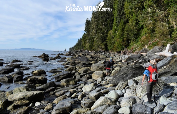
From Thrasher Cove to Owen Point, we clambered over boulders and drift wood for several hours. I stopped to take pictures of shells and sea life, and to point them out to Angie. She commented repeatedly on the dry climate of Colorado and was just as intrigued as I was by the ocean.
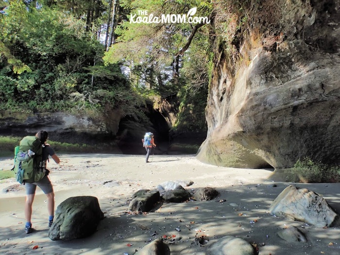
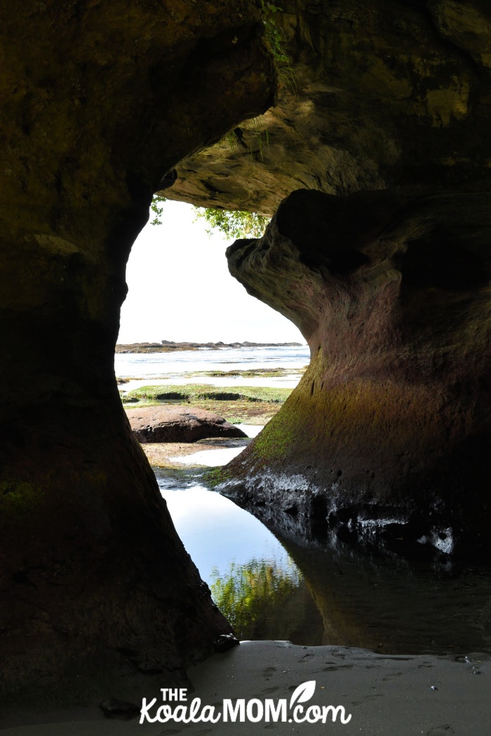
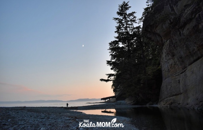
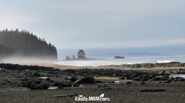
We reached Owen Point at noon with a low tide (as required). The sea caves there were just as amazing as we’d heard, and were well-worth the morning spent bouldering. We stood in the cool dimness of the cliffs carved by seawater, taking pictures.
Then we clambered up onto the sandstone shelf. The next several hours of our hike were among the easiest, as we simply followed the sandstone shelf. We had to hike around tide pools and surge channels, and avoid slippery sections of rocks, but the sandstone shelf was flat and solid (unlike most other parts of the trail).
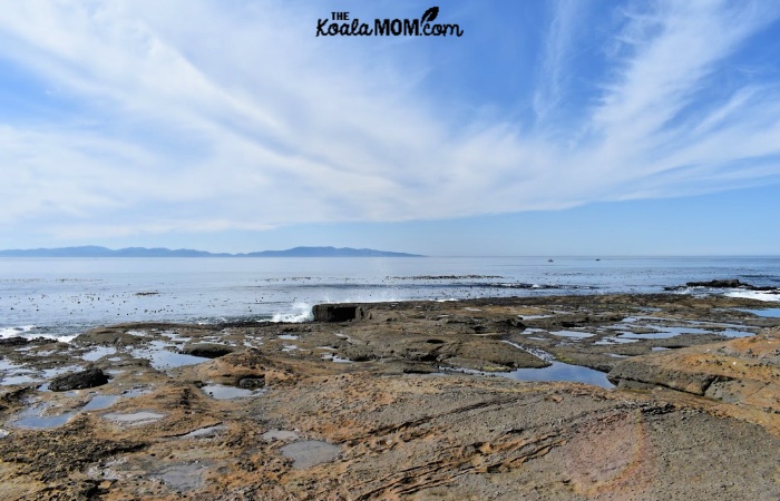
We saw a heron before noon and an eagle afterward, as well as fishing boats out to sea and urchins, chitons and anemones in the pools.
At the beach access (marked by old buoys hanging from the trees), my cousin finally agreed to stop for a break. We enjoyed our trail mix and dried fruit while watching the waves crash. Then we hiked on to our first cable car crossing at Camper Bay.
Here, I also refilled my Platypus, which was also a mistake. I’d already drank 3 litres of water that day, but had a mild headache. The extra weight of that much water, however, felt unbearable for the next several kilometers before Cullite Cove.
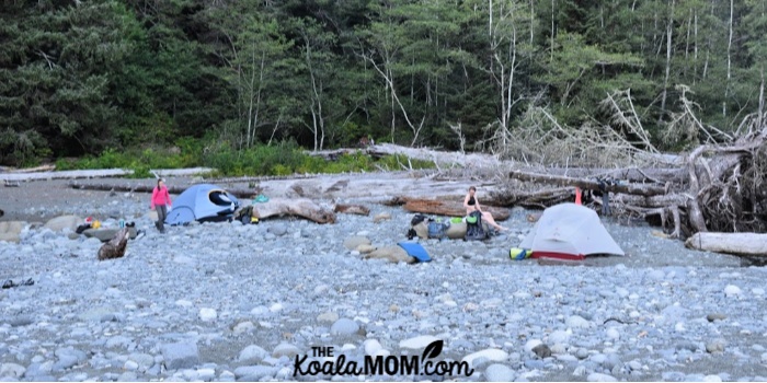
We’d been warned that Cullite Cove only had ten campsites left, as the others had been washed away. Arriving there, we found the beach again dotted with tents and the ten spots within the forest already occupied. Like the other hikers, we pushed aside the perfectly round rocks that covered the beach until we’d made a sandy spot big enough for each of our tents.
Then my cousin and her friend went swimming in the pool at the end of the river, while I soaked my sore feet and took pictures.
WCT: Day 3
Our hike on Friday morning began with a cable car ride across the river. My cousin and her friend went first, and then yelled back, “Don’t come!!!” I laughed, thinking they were joking, until they shouted, “The bear spray exploded!”
Somehow, in getting out of the cable car, the bear spray had caught in such a way that it went off, leaving my cousin and her friend coughing and gasping. When the pepper had drifted away in the wind, my friend and I followed. We put the bear spray in a Ziploc bag for the rest of the hike; so much for bears!
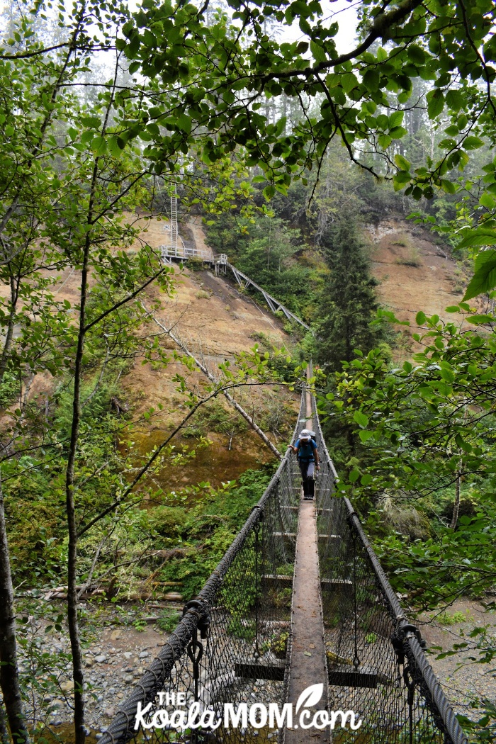
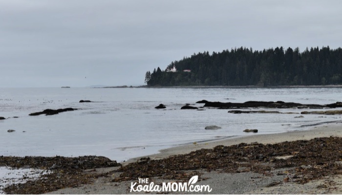
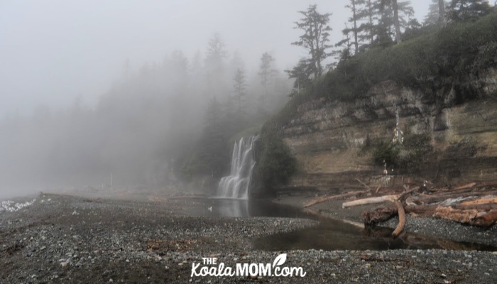
Scenery on day 3 included a suspension bridge over Logan Creek, a waterfall at Bonilla Campground, and Carmanah Lighthouse. On the beach, I saw remnants of sea cucumbers, moon snails, sea urchins, crabs, kelp, mussels, limpets, coral, and other sea life. Sea lions barked at us from a rock in the ocean.
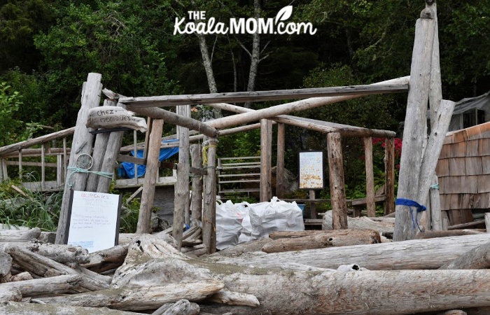
We also passed Chez Monique, the much-anticipated burger stop of the West Coast Trail. Unfortunately, it was closed this year because both Monique and her husband have passed away. The sign says that it’s under renovation and will re-open next year.
We reached Cribs Creek at 4:30 in the afternoon, after a 16-km, 8-hour day. A line of sandstone rocks creates a breakwater, over which we watched the waves crash until the incoming tide had filled the shallow lagoon between the beach and the rocks.
We camped between a German couple and a Swiss couple, whom we’d been leapfrogging along the trail since Thrasher Cove. The evening’s entertainment included a driftwood fire and a game of euchre. My cousin had packed a deck of cards, and we had enough time in camp at the end of the day to play a game together most evenings.
WCT: Day 4
This was the day for which we’d been bracing all week, as it was the longest on our trip: 17 km. However, it was also one of the most scenic, memorable days of our trip.
Cribs Creek had only one outhouse, which proved to be an excellent place to gossip with fellow hikers while waiting your turn. We knew that we were hiking into easier terrain, and felt sorry for the hikers heading the opposite way, or doing the trail from the “easy” end to the “hard” end. As there are no campgrounds between Cribs Creek and Tsusiat Falls, however, all of us had to endure that grueling day—and its rewards.
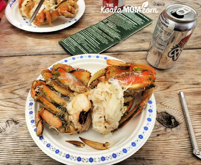
All morning as we hiked, our thoughts were on crab dinner. We hit the Crab Shack on the Nitinat Narrows just after noon. Dropping our packs, we greeted the other hikers and eagerly ordered our crab dinners. While we waited for them to cook, we sipped cold pop and joked with our fellow hikers about pack weights, the “take it or leave it” bin, and the trail thus far.
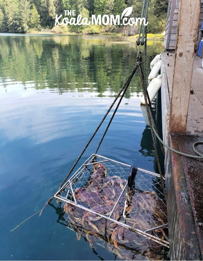
Eating a crab is something like hiking the West Coast Trail. It’s not easy, but it’s worth it. We cracked the shells with the nutcrackers provided and sucked or pulled the soft, sweet meat from inside. After several days of dried foods, the baked potato and fresh, juicy meat were delicious.
Then we presented our permits to the boatman, who ferried us across the Narrows. Part 2 of the WCT began!
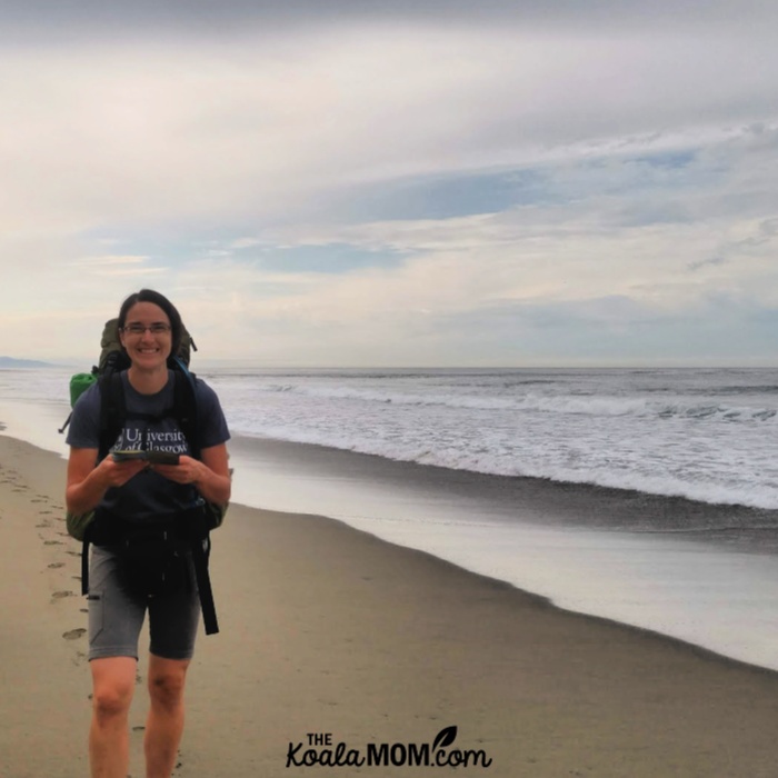
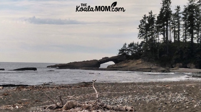
Our afternoon was spent mostly on the beach. We explored a natural land bridge and then trudged over soft sand towards camp. The crab dinner kept us going for several hours, but eventually I called another break, as my feet and legs were aching.
The shifting rocks and sands of the beach were exhausting at times. I tried to hike in my cousin’s footsteps (she marched ahead like an automaton) or right at the water’s edge, where the sand was hardest. Once, both of us heard the crash of a huge wave and dashed for up the beach, but my boots got soaked anyway.
The nice thing about beach hiking is that it’s easy to see your destination. A bright spot of colour on the beach ahead, then faint wisps of white smoke from a beach fire, were joyous signs that we’d almost reached camp. Tsusiat Falls hid itself around the corner of the cliffs from us. We choose a space on the beach between the driftwood to set up our tents, then went to see the “showers” of the WCT.
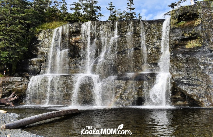
Bathing suits had been one of the items we’d debated about taking. My cousin and her friend packed their bikinis, and swam nearly every day (even in the ocean). In nine years of living on the west coast, I’ve waded in the ocean, but never actually been any deeper than my knees—or even wanted to. The ocean is cold. I doubted I’d swim on the trail, even if I was hot and sweaty, so I decided not to take my swimsuit. Tsusiat Falls made me regret that choice.
The water here was warm after tumbling down the sandstone cliffs into a pool. Everyone who arrived at the beach also jumped into the pool soon after setting up their tents. I waded in the pool and then decided to jump in. Many other hikers were swimming in their underwear, so I left my pants on the shore and dove in with my T-shirt on. The pool was cool in the heat of the afternoon, and the cold water pounding down on my head was bracing and refreshing.
With our showers out of the way, we made supper and a fire and played cards. Despite stopping for crab dinner and hiking the most kilometers yet on the trail, we’d arrived at camp earlier than ever before—only 4 pm. Tsusiat Falls was the perfect place to have extra time to enjoy the beach and scenery.
WCT: Day 5
We woke up to a foggy Sunday morning at Tsusiat Falls. We cooked our breakfast on the ledge of rocks against which we’d camped, then packed up our gear. Two ladders led us up off the beach and into the forest.
We’d planned to have an easier day after our long day. However, when we arrived at Darling Falls at 1:30 in the afternoon, none of us were ready to quit. The next campground—and also the last—was only another two kilometers further.
Clouds had also drifted in and began to rain. We dug out our rain gear and marched on. Just before Michigan Creek, my cousin stopped her trek across the sandstone. We were a dozen feet away from the beach, but ahead of us, a black dot at the end of a fallen log, was a bear. We talked loudly to the bear and I snapped pictures as he looked at us and debated what to do. Finally, he moved slowly up the log and disappeared into the forest.
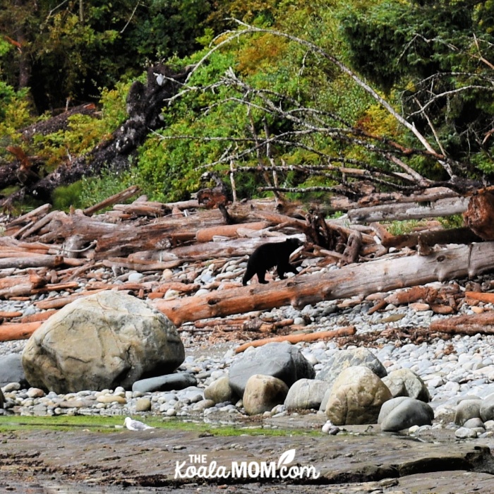
We continued on to our campsite. As we were cooking dinner, the hikers next to us yelled, “Bear!” We came running. Down the beach was the same bear (we guessed), who had apparently circled the campground. We stood ready to yell if he came any closer, but after deciding that the crowd on the beach was too much, he ventured back into the forest.
That night, we joined our neighbours (a pair of German doctors) at their fire. We’d decided not to start a fire, due to the rain, but they’d managed to get a roaring blaze going. It was warm and cozy to sit there as darkness fell, sharing stories about our travels and the trail and why we’d all come to be there.
WCT: Day 6
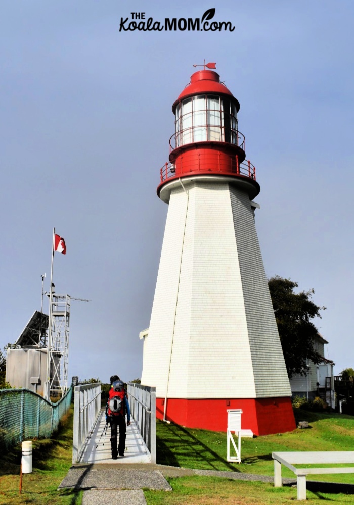
For me, this day was bittersweet. It was the end of an amazing week and while I was looking forward to a hot shower, soft bed, and seeing my kids again, I was also sad to leave behind the WCT. The last 12 km of trail took us through the forest, past more derelict logging equipment and Pachena Point Lighthouse.
I joked with my cousin and her friend that they were smelling the burgers and beer in Port Alberni, for they were trucking along at a good pace. We smiled at clean, happy hikers heading the other way, and my cousin kept saying, “Don’t tell them it gets harder.”
After a short, foggy jaunt along the beach, we reached the Pachena Beach Access. We checked off the trail and attempted to clean up a bit (using wipes my cousin had brought along, because there were only outhouses at this trailhead). I bought myself a T-shirt and my friend bought a bandana. We greeted our fellow hikers and watched them pile onto the West Coast Express for their ride back to civilization.
My uncle arrived at 3 pm, an hour later than he’d planned because of the road into the trailhead. For the next two hours, we bounced along a gravel logging road to Port Alberni. There, we decided on the local pub as the most appropriate place for slightly smelly post-WCT hikers to grab a meal, and ordered burgers and drinks. We reached Victoria long after dark and took turns unpacking and showering. The adventure was over.
Final Thoughts on the West Coast Trail
Somewhere along the trail, another hiker asked me if it was what I’d expected. That question was hard to answer, because I’ve been hearing about the trail for two decades now. My best friend’s older sister hiked the trail in pouring rain, and a friend of my husband’s was airlifted off the trail after injuring her knee.
I’ve done plenty of hikes in the Rocky Mountains (including a ten-day backpacking trip with my mom before starting university) and day hikes on the West Coast. Angie has hiked with me in the Rockies and with her family in Colorado. My cousin is incredibly fit (she does a fitness bootcamp regularly and is a spin instructor), and her friend is an archeologist who works outside frequently. I was thus confident that our group was strong and fit and able to handle the trail.
The West Coast Trail is a rugged trail. Aside from the challenges of carrying 30-40 lbs, there’s the ladders, mud holes, fallen logs to climb over or under, tide tables to read, rocks to scramble over, and constantly changing terrain. This trail also features some of the most spectacular scenery I’ve ever seen, as I hope my ictures have shown. From the history to the natural landscapes, there was something new almost every hour to enjoy.
This was my first time hiking the WCT, but it won’t be my last.
If you’re planning to hike the West Coast Trail, check out these resources:
- Parks Canada: West Coast Trail (reservations, history and more)
- See Her Travel: Hiking One of the Best Hikes in Vancouver Island
- Outdoor Vancouver: Hiking the West Coast Trail
- Blisters and Bliss: A Trekker’s Guide to the West Coast Trail (a highly recommended, honesty and funny book on the WCT – also the book sold at both trailheads by Parks Canada)
- Hiking the West Coast of Vancouver Island: An Updated and Comprehensive Trail Guide
For more pictures of my WCT adventure, drop by Instagram.
Have you hiked the West Coast Trail? What was your favourite or least favourite parts?
No Responses Yet